
INTRODUCTION
Hundreds of people have become interested in open water swimming in the last few years. This ranges from extreme experiences like ice water dipping or endurance swimming many miles, to just keeping fit and enjoying nature. In Lancaster/Morecambe we have a range of options – the sea (at high tide +/- 1 hour) – the lakes – pools and quarries – or the river Lune. All have their own special magic and carry varying levels of risk. I love them all – the epic surroundings and big waters of the Lakes, the unique character of Morecambe Bay, the sociability and safety of Capenwray or Wyresdale Lakes. Then there is the river Lune
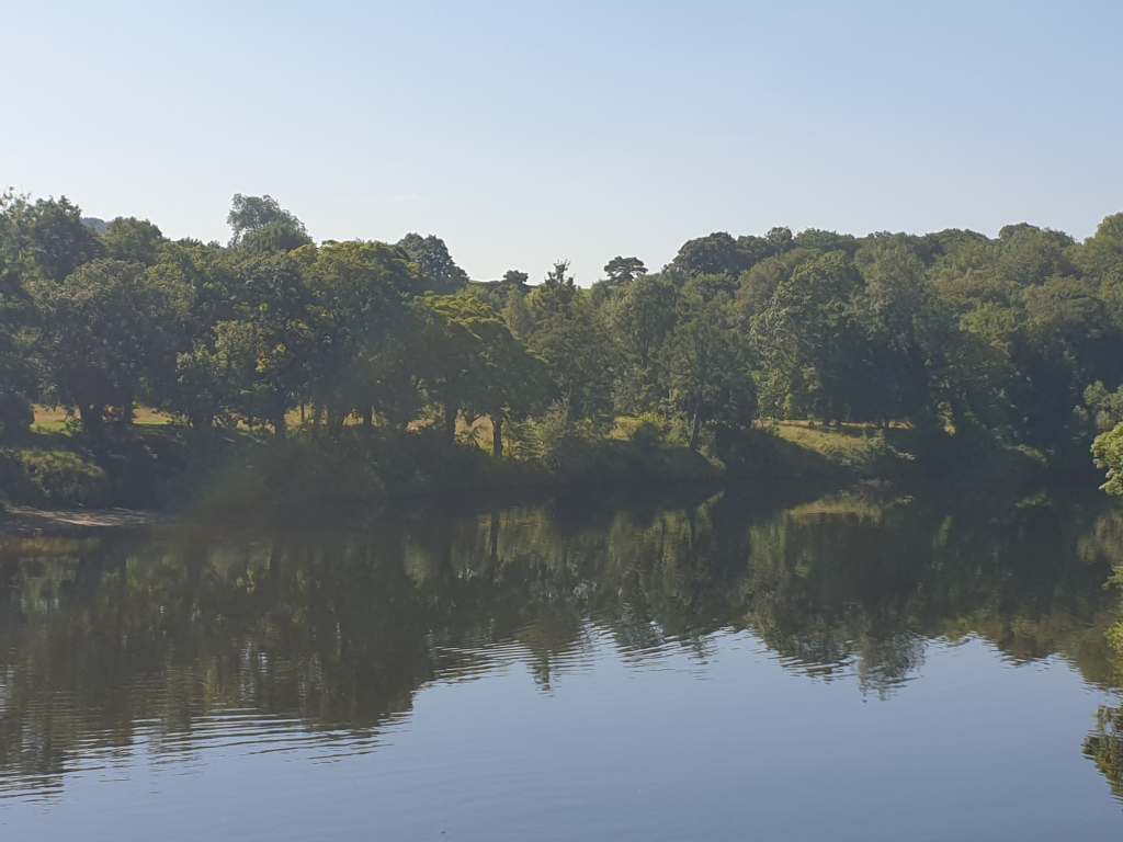
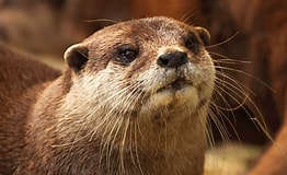
I must say I have a special affection for the river. Although I swim in many places, I most often swim in the there. It has a peace and wildness unlike the others. It is lined with woodland and you are closer to wildlife there. I have swum with swans, a variety of duck species, heron, cormorant, coot, moorhen, gull, tern and kingfisher. You can also see many woodland birds, and raptors such as kestrel and buzzard. Deer come to drink and there are the occasional water vole and water rat. If you are super lucky you may see an otter.
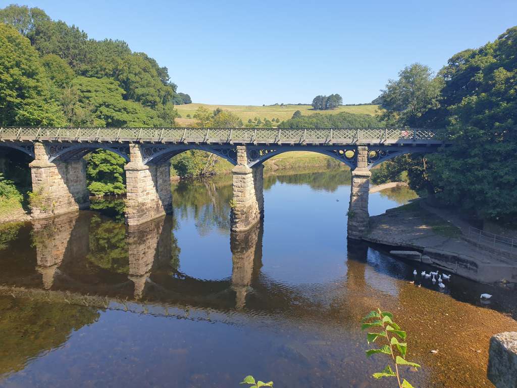
Swimming the river is like a journey through our life and history, from clatter of a passing rowing eight to the strange hidden folly ‘bridge to nowhere’ above Crook of Lune, the 19th Century majesty of the aqueduct or the railway bridges at Caton and Halton and the thundering motorway bridge with its four fantastic echoes. It is the traditional place for ordinary Lancaster folk to go for a dip and a picnic in the summer and where (according to local legend) Jon Galbardi first imagined the Facebook group called MALLOWS which is a great ongoing resource about all the OW spots locally and beyond – well done and thanks Jon and the others who keep it up and running.
ABOUT THE RIVER: – Although a lot of people do use the river Lune, perhaps more seem to have concerns about swimming in it. Is it CLEAN and SAFE and if so where is best to get in and if I want a longer swim where can I rest or go to get in and out at easily? Like all water bodies risks exist, some of which are specific to this one and so it is a good idea to get to know it. The rewards of swimming at sunrise or sunset in water smooth as glass are worth the effort. The chance to take a short swim or challenge yourself to swim for a couple of hours or more safely and without stopping, is rare.
WHY THE RIVER – So, as I mentioned, the river and its banks are wooded, full of wildlife, natural and wild but also tell a historical story. As the sun rises near one end and sets near the other the light show is often spectacular. Beyond this you can easily begin with a 50 or 100m swim from any of the jump in/out points I mention below, but then extend your swim distance and time as your skills improve or you get to know the water better. For example, from the Jetty (near the aqueduct) through the aqueduct itself, back along the other shore and across to the jetty is 500m. Denny beck slip to the 1st motorway bridge is 800m (don’t forget to enjoy the echoes when you get there) and a mile there and back. Any circuit involving the Jetty and Denny Beck is just over 5000m. There are loads of places to rest and mostly close to the shore you will not be out of your depth (but don’t take this for granted) This is all straight-line swimming, and so no view is the same and its great to learn spotting/sighting. That is, where you learn to swim to an objective as directly as possible. Only the lakes can offer this but, magnificent as they are, they have their drawbacks too. They are a bit of a drive from here, can seem big, are occasionally rough and actually quite scary for the uninitiated,. You might even want safely support for a long swim. So, if you are training for a long swim or triathlon its great (and free). If you just want an hour to be with yourself and your swim stroke there is nowhere better. I can highly recommend a sunrise with cool water and the swans.
THIS GUIDE – WHAT AND WHY
So, I felt it was worth putting together a guide to swimming safely here. I think its worth going through some general safely/enjoyment points first. Then some specific hazards and finally draw you a map of the different jumping in points. I will talk about the river itself, why swim where in it particularly, where to swim from, and to, general safety advice on river swimming, what the local hazards are, and what kit to use and when. I hope this will give people the confidence to take the plunge and enjoy this great opportunity we have.
Although there are many spots further north, my knowledge is of the final 13 kilometres (9.5 miles) from just North of Hornby to Lancaster so I will talk about that although some of the information is relevant elsewhere. It is, apparently, possible swim the entire river but only at high waters and it’s probably quite risky. I have swum from Bull Beck at Caton to Lancaster (7.5 miles/11.5km) which was fantastic.
This is information is drawn from my experience and not an exhaustive list – remember YOU ALWAYS SWIM AT YOUR OWN RISK
GENERAL OPEN WATER SWIMMING INFORMATION
The usual warnings about swimming in open water apply here. This is a brief note only and there are much more in-depth explanations elsewhere – like this one…. Safety Guide For River and Estuary Swimming – Swim Secure , Cold water shock | Water Safety Scotland amongst others. For training – Ceri at The Aquatic Body, https://en-gb.facebook.com/theaquaticbody, Heather at http://www.southlakesswimming.co.uk, Bob at Adventure Swim Coaching (www.facebook.com/groups/484955675304636) or Annie at attitudeswimcoaching.org
YOU CAN DO IT… or can you – Plan your swim and be sure you are fit and healthy enough to do what you plan, only swim sober and go carefully.
PLANNING – If you don’t know the water it’s a good idea to do as much research (read this for example) as you can and go with a buddy.
RIVER GEOGRAPHY – So the river flows downhill, from the Howgill Fells so always has some amount of current and flows toward the sea, but is not tidal (above Skerton Weir). The current is stronger the more water is in the river as a result of rainfall levels. It is usually colder after rain. The river has deep and shallow areas and bends with the flow. These bends are called meanders and affect the speed of the current. The outside of a bend usually flows faster than the inside although the difference may not be great. This said pick that shore if you are going against the current and there is no other reason not to. The bed is usually stony but at the banks quite muddy, but this is not too deep and is only a hazard if you are not careful and slip, although water shoes can be a good idea. Beware of sunken logs and other debris close to the shore.
EQUIPMENT – All the time: Swim cap (you lose a lot of heat through your head), a tow float you can put thing in and use to rest on if necessary, nutrition, waterproof watch (even if its basic) to see how long you have been in, swim costume, goggles (if you like, but a must on longer swims) and, if you like, a phone (in an extra dry bag). In Early/late season (April-June and Sept-Oct) in the UK – temperature – 12C to 16C: Full 3/5 or 3/2 swimming/triathlon wetsuit (possibly thermal if you are prone to cold), swim thermals may help too, neoprene hood and silicone swim hat or 2 hats, neoprene swimming gloves (swim specific) and bootees. Mid-season – (July and August) temperature 16C-20C Again this depends how you, feel so know your needs and don’t take risks – Wetsuit, shortie wetsuit, swim thermals or a cosy – this depends on you but a wetsuit is advised for longer swims – 30 min+, swim hat, goggles. You can mix and match as the water warms up. Winter – get trained and ask an expert!!! Try to have good quality gear and look after it it’s a lifeline and expensive – there is nothing more annoying than turning up swim in open water without your tow float lead or knackered wet suit and having to abandon your plans.
COLD AND WETSUITS – there are various kinds of wetsuit. Those designed for surfing and the cheap general use ones in supermarkets have ‘flatlock seams’ which allow water in and are cloth covered, swim specific ones have a combination of blind, welded or taped seams and so little water gets in keeping you warmer and are smooth to aid movement through the water but are not as durable. They are quite expensive (75.00 -700.00) but can be bought 2nd hand but with caution. Key is getting the right size. http://www.attitudeswimcoaching.org have a more in depth article on this and for the real ins and outs try http://www.buy4outdoors.com/blogs/buy4outdoors-blog/a-guide-to-wetsuit-stitching-seam-construction, https://youtu.be/HJuiv1-0VRU give another video overview on the subject.
NUTRITION – Please remember that swimming is physical exercise so fuel and hydrate properly, especially on a long swim but even on a shorter one (be well fuelled and hydrated before and eat and drink afterwards. I use a dry bag float from www.planetx.com with water in a bottle and a banana or more inside for longer swim adventures. I also have at least one energy gel in a belt round my waste (If you swim more than 1 hour then 1 gel per hour, a handful of jelly babies or a banana per hour). Have a warm drink for when you get out or even for the route. If you are swimming all day take some solid food too. Failure to fuel and hydrate can lead to exhaustion, cramp and you will get cold more quickly.
COLD – The key is to know your limits – start slow and build up. Even if the air is warm the difference between the cold water and warm air can cause problems like cold water shock or hypothermia. You can buy a digital thermometer very cheaply to check the temp. Below 10 degrees is for the well acclimatised only – they know who they are, everyone else should avoid going in for more than a few moments. Fourteen to 18 degrees is fine if you are used to cool water, but a wetsuit is advised especially if you are going far. In cold water consider a thermal wet suit or wear swim thermals under your suit. If you get out with brain fog and feeling unsteady on your feet that may be the onset of hypothermia so adapt your time in the water and nutrition accordingly. It’s a stealthy little sod but can be extremely dangerous, so beware and know and test your limits. When you get out get dressed asap as, as the water evaporates you get colder FAST. Put on a woolly hat and dry robe or warm coat then the rest of your clothes. A survival blanket might be a good idea to have with you and of course a hot drink. Spiced chai is especially good as the spices warm you up ‘chemically’ as well as the warmth of drink itself. Warm ‘naturally’ before having a warm shower. If you get Reynards (numb fingers/toes) put on gloves/thick socks and let them thaw naturally don’t run them under hot water.
TIREDNESS – It is easy to get tired and not be aware of it this, can also lead to cramp. So know your limits in terms of distance and time and build up slowly – as you know your limits and the location better the more you can safely do. Remember that cold affects your energy levels so when its colder the less you can do. Remember to fuel (eat) and hydrate.
WATER QUALITY – Do your research. A good indicator is the health of the ecosystem. So if many species especially fish like salmon and trout live in the water its probably OK.
LOCAL HAZARDS
RISING WATER – The river can rise very quickly after rain increasing flows massively and making it very dangerous. Recently it went from a safe place to swim to a raging torrent in ½ an hour. So should I avoid it? – that’s less than my normal swim time. The answer is NO just do your research and be prepared. In the sea you can be caught in a rip, a wind can get up in the lakes and conjure up a big chop. So what to do? Before you go check the weather at www.ventusky.com. Use this because you can check yesterday’s weather which you can’t do on other sites. Has its rained a lot in the Lune Valley (South of Kirby Steven)? When you look at the precipitation map is it showing green for more a couple of hours? did it rain all night? It takes from 4 – 7 hours for water to enter the river. Now look at www.riverlevels.uk/lune-caton-with-littledale-caton# it gives you the latest measurement and if you scroll down to the graph you can see how things are changing so you can predict when to go. If you are a good swimmer 50cm (as measured at Caton) in shallow places like Denny Beck is OK and 75cm at deeper wider locations like Holiday Inn or the Jetty. BUT there is no substitute for pooh sticks. Get a stick and throw it in the water. See how fast it moves. If you can swim consistently and easily three times as fast you will be fine but limit your swim to what you can manage.
If in doubt take a rain check!
COLD – The water in the river mostly falls in the high COLD fells near the source. This means that even when waters have subsided after rain the TEMPURATURE can drop dramatically. Don’t assume that if it was tepid after a warm dry spell of weather it won’t be much colder after rain (as much as 5C). So, plan accordingly.
WATER QUALITY – Is the River Lune clean? Overall, the river is very clean. This is indicated by the fact that it is home to three species of trout and otter, who would not be there if it was toxic. There are some issues with chemical run off from the land and potentially sewage being released from time to time, but this is mostly when the river is high and not swimable anyway. This said we need to keep fighting this horrible practice. Also, like most places, it is best not to drink it, have a shower when you get home and wash your gear.
OBSTACLES – in places there are trees, sunken branches, industrial debris and rocks in the water close to the shore and occasionally further out. Keep your eyes open above and under the water and swim a little offshore but not in the middle. You will soon get to know where they are – This is not exhaustive and by their nature they appear and disappear regularly but…. There are shallows between Bull Beck and Crook ‘o’ Lune, under the Crook ‘o’ Lune Bridges and 100m from those bridges toward Lancaster. On the east shore below there, there are some rocks and trunks and the entrance to the gorge is to be avoided as the water flows very fast here. Denny Beck is safe but is shallow near the weir, and can run faster than downstream. Two Hundred metres south there is a fallen tree in the river and the more southerly motorway bridge is shallow at both sides so swim through the middle of it. Below this the west side has many small overhanging trees and on the east side after 300m there is an area of tree trunks and rocks in the river. Some of these are sunken. After the aqueduct there is an area on the east side where there is an old jetty or something – twisted metal anyway – avoid this. Near Lancaster cross to the west side to avoid the weir which can be very dangerous but in low water it is shallow near it – Generally – SWIM AT YOUR OWN RISK – look carefully, learn your river and you will be fine.
OTHER HAZARDS – Fast moving rowing boats occasionally fly up and down the river – they are beautiful and exciting but remember they go very fast and often can’t see you as they go backwards. Luckily, they are quite noisy so keep your ears peeled. But generally, stay fairly close to the shore but not too close (4/5 metres). This is good general advice too. When crossing the river check for any boats approaching and let them pass. There are also sometimes evil midges so use waterproof insect repellent.
WHERE TO SWIM
Places to get in the river.
The river lune rises from a spring near Kirby Steven and flows to the sea at Glasson Dock. For much of that journey it is shallow and fast flowing. Although there are swim spots along its length the opportunities for swimming rather than dipping are mostly within the last 10 km before the tidal section at Lancaster. I guess some of the tidal section is swimable but I don’t know it well, so I’ll focus on the area Hornby to Skerton Weir.
Hornby
At Hornby there are two places to get in, one at the Loyne Bridge and one a few hundred metres to the North. The river here is quite narrow and shallow and because of this it runs quickly when the river rises and can become unswimable in dry weather. These are more dip spots really. In general, the further down river you go the better it is for longer distance swimming but there may be more risks.
Bull Beck
Bull beck is a 400m stretch opposite Bull Beck car park (with café) before the river shallows toward Crook ‘o’ Lune. This a convenient and safe spot but again shallow in dry spells and fast flowing in wet weather – a good introduction maybe but you can only swim so far.
Crook ‘o’ Lune North
This is just to the North of the Low Rd Bridge and near the Lancaster Cycleway and Crook ‘o ‘ Lune car park. It is worth noting all the spots I mention are accessible from cycleway. This is a nice safe place to get in but can be a bit shallow. You must swim in the middle of the water. Also, the farmer on the east shore is (quite reasonably in a way) not that happy with visitors because of some people’s behaviour. There are shallows under the bridge so best start a long swim below the bridge.
Crook ‘o’ Lune South
Enter the water under the bridge (there is a shallow section under the bridge which you need to walk past in or out of the river) or at the field that slopes down to the river on the Caton side of the bridge. It has a nice easy place to get in. In the car park you can find Woodies café which is open in the summer and weekends.
This is the first real deep water entry point to perhaps the wildest and most tranquil section of the river. The river disappears round a bend, through a woodland and down to the entrance to the gorge some 1.5km to the south. There is a shallow section (in low water) after about 100m before the old railway bridge but passable with breaststroke rather than crawl. It flows faster than deeper areas. It is better to stay on the inside of the bend (east shore) where it is deeper and slower flowing. You can swim as far as you like.
It is about 100m to the shallow section. This first section is safe and feels like you are in the middle of nowhere. Past the old bridge there is a gorgeous long (1300m) deep swim, away from houses and the road. The riverbed is a beautiful landscape of rocks eroded by the passage of water. There are many rest spots en route. The river is wide and deep, so the flow speed is less susceptible to rises in the river level (but still be careful). That said, for good swimmers the depth at Caton, according to the site mentioned above, should not be more than 80cm. Reading this does not mean you shouldn’t play pooh sticks to assess whether you can swim back against the current. There is a downstream exit/entry on the left at the top of the gorge (1km walk/ride from Denny Beck). If the current is strong remember that it is at the top of a gorge where the river flows very fast so avoid getting in there at those times. An access road joins the cycle way at that end of the swim with a 1km walk back to the start through the fields or along the cycle way. Otherwise, be sure you can swim all the way back although there are exit points along the way if you feel you want/need to. It is a 1/2 mile (700m) walk to Denny Beck where you can get back in to swim further toward Lancaster. The meandering nature of this section makes it good for practicing spotting/sighting and it is very beautiful.
Denny Beck
The Lancaster Rowing Club slipway slopes gently down from the cycleway and car park. It is perhaps the easiest access to the river of all and very busy at weekends in the summer. To your right is the Halton Bridge and weir to your left the rest of the river. It goes all the way to Lancaster, some 3km as the river meanders if you are feeling brave (remember you rarely swim in a straight line so your distance may be longer than on the map). You can however swim any distance you want from here. Soon after the slipway the river widens considerably. This is decreasingly (to a point) affected by level rises (don’t go in above 80cm though). The drawback with Denny Beck is that near the slip (50m) it is shallow so the water begins to run quite fast when the river is not deep (50cm at Caton) making swimming back in quite arduous and can be a bit of a walk to deep enough water when lower. Pooh sticks a must here.

South from here there are some great swims passing woods on one side and a series of grand houses and the military training camp on the other as well as some rest or exit points. A lot of people swim to the motorway bridges. The first one has multiple echoes so have a little sing and listen! These are 800m away so just more than a mile in total there and back. Continuing south you need to pass through the centre of the next bridge span as it is very shallow on either side. I tend to stick to the western shore between Denny Beck and the motorway bridge. After that I cross the to the east side as far as aqueduct and the jetty as there are more exit points in case of problems arising, although there are some dead trees in the water in some places, so you need to be careful. Beyond the jetty, but well before the weir, I cross to be able to make landfall on the west side of Skerton Bridge where there is some decking to get out on.
Holiday Inn
If you turn left on the Lancaster side of the Holiday Inn Hotel on Caton road, drive to the bottom, park and cross to the cycle way, you will find a large gate and then a very steep slipway. Take care descending the slip and enter the water. The river here is 80m across (good for speed or interval training) and short swims are good from here. It also gives the opportunity to go against the current to Denny Beck meaning you get some help on the way back (3400m, 2miles+) or to the motorway bridges (1400m, just under a mile) and back or to the aqueduct or the jetty beyond. Take the second arch of the aqueduct on either side but be careful as some rowing craft use this too. You can climb out easily at the jetty or stand in the shallows and have a rest. The intrepid can then go on to Skerton of they wish.
Jetty/Aqueduct
These are accessible from the canal path at the aqueduct or the Lancaster Cycleway taking the small path into the bushes 50m from the aqueduct. Here is a start point to head north against the current before returning with the flow. It is also wide here and good for focussed training – tracing a square from Jetty to aqueduct down the other side is 500m.
Skerton Pier
Just on the West side of the river, before the flats, is a start point to do the whole swim going North (6.5km min or 4 miles), or both ways (13km or 8 miles) or any distance in between. This is perfect if you are planning a Windermere one way swim for example. I think that apart from the lakes it is one of the few places to do a swim this length in reasonably clean fresh water in NW England, and certainly in a river. Landing here, stick tight to the west shore to avoid the weir the whole area around which should be avoided anyway in higher water.
If you were nervous about swimming in the river or have only done some swimming there or are even an old hand, I hope this encourages you to take the plunge or do more. I love it, so should you. Please subscribe to the Blog and you will get notifications of any articles we post. Also leave a comment as its nice to see who has seen my work and also I may have missed out something – so tell me if I have.
